The geocoding tool allows you to retrieve latitudes and longitudes from an Excel file like this one: 
In the Tools menu, click Geocode. 
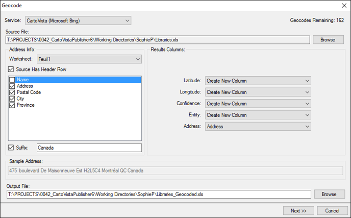
File and column selection
In the Geocode dialog, you can:
- Choose a geocoding Service.
- the licence of the Publisher includes a geocoding of 5000 addresses with Here.
- It is also possible to use Google services by providing an API key.
- Navigate to your Source File.
- Select the columns containing relevant Address Info. The Address example helps you to select the columns.
- Add a Suffix applying to all data, such as the country, to get better geocoding success.
- Insert new Result Columns such as latitude and longitude or details about the geocoding success.
- Determine the Output File folder
Geocoding process and result analysis
The Next dialog launches the tool and shows the global analysis of the geocoding success. 
Open the Output File
The Open button displays the resulting Excel file. For example, new columns containing the geographic coordinates and details of the geocoding success will be added. 
Add the Point Layer
Use the drop-down list to generate a point layer in ESRI Shape file (SHP) or MapInfo Table (TAB) Format. The Add button will send it to the Map Sources Manager, ready to use in your maps.
